Thursday, March 26, 2015

EPA looks into road project


EPA looks into road project


A road is shown off of Buttermilk Road just off Interstate 20/59 at exit 77 in Tuscaloosa, Ala., Tuesday afternoon.
Jason Getz | Tuscaloosa News
Published: Tuesday, November 24, 2009 at 3:30 a.m.
Last Modified: Monday, November 23, 2009 at 11:21 p.m.
TUSCALOOSA | Environmental agencies are investigating a complaint that the Buttermilk Road widening project is taking a toll on the environment.
Contractors for the Alabama Department of Transportation are working on the 2.27-mile project to widen Buttermilk Road to five lanes from between Bradford Boulevard and Interstate 20/59.
Earlier this month, Tuscaloosa environmental activist John Wathen photographed what he claimed were violations of erosion control regulations, among other offenses.
“I’m filing complaints because there are some pretty egregious violations,” Wathen said. “Granted, we had a lot of rain that day, but it wasn’t anything exceptional. ALDOT simply did not prepare the silt fences right.”
Wathen forwarded photos that he snapped on Nov. 10, the day an approaching tropical storm dumped about 3 inches of rain across the region, to the Alabama Department of Environmental Management and the U.S. Environmental Protection Agency.
Officials for both agencies confirmed that they were aware of the complaint and were looking into it. ADEM said the EPA was taking the lead in the probe.
Laura Niles, a spokeswoman for the EPA’s Region 4, said the region’s storm water action team was currently examining the damage.
“They are definitely evaluating whether enforcement action needs to be taken at this time,” Niles said.
Officials for ALDOT said that while sediment and soil did escape the confines of the silt fences along the construction area, it was not the result of poor planning or lack of concern, it was because of the storm.
“What you saw (two weeks ago) is something we cannot prepare for,” said ALDOT spokesman Tony Harris.
Barry Fagan, assistant construction engineer for ALDOT, said the 2 to 6 inches of sedimentary runoff covered an area about 600 feet long with an average width of 5 to 6 feet.
Crews will clean this up, he said.
“When we lose sediment, it’s our policy and our plan to mitigate that sediment loss,” Fagan said.
Within days of being notified of the complaints filed by Wathen, ALDOT officials met with him and a member of the board of directors for the Friends of Hurricane Creek, the Tuscaloosa-
based environmental group that Wathen heads.
Fagan and Harris said protecting the environment in the midst of road construction is a priority for ALDOT.
“It’s not just this particular job,” Harris said, “any job that we’re notified we have issues ... we get involved.”
Wathen, however, said he fears it’s a sign of things to come.
Part of the Eastern Bypass, a large-scale road project that’s being overseen by ALDOT, is still slated to go through Hurricane Creek and the famed M-bend, a popular canoeing and recreation area known for its rare wildlife and rock formations, as well as a swimming area that residents have used for decades.
Wathen is concerned that
ALDOT’s inability to control erosion on Buttermilk Road, which he said allowed dirt and mud to wash into tributaries that feed Hurricane Creek, is a sign that the M-bend could be harmed if plans for the four-lane highway go unchanged.
“It’s a clear indication of what’s going to happen if they get the bypass to go through,” Wathen said. “Every tributary I saw leaving that (Buttermilk Road) site was heavily impacted with silt and construction debris. They can’t do that in this watershed. If they’re going to build the Eastern Bypass ..., then obeying part of the law part of the time isn’t good enough.”
Fagan said that he and ALDOT are aware of the environmental significance of Hurricane Creek and although he stopped short of guaranteeing that the creek will not be disturbed in any way, he said that ALDOT is sensitive to the issue.
“We recognize, and have recognized for several years, that we’re going into a sensitive area,” Fagan said. “We understand that it’s supersensitive and we’re recognizing that early enough in the process that we will take extraordinary efforts to minimize the damage to that area.
“But we work in a world of dirt and water.”
Reach Jason Morton at jason.morton@tuscaloosanews.com or 205-722-0200.

Eastern Bypass editorial


EDITORIAL: Let’s not pay twice for those apartments


Published: Tuesday, December 14, 2010 at 3:30 a.m.
Last Modified: Monday, December 13, 2010 at 10:56 p.m.
The Northport City Council should proceed cautiously as it finds itself in the middle of a tug-of-war between the Alabama Department of Transportation and a private developer over a 10-acre property at U.S. Highway 43 and Tom Montgomery Road.
The risk is that taxpayers could end up paying for the property twice: once in subsidizing the construction of an apartment complex, and a second time when it comes time to tear down those apartments to build a state highway.
The developer, David Morrow, wants to build a low-income apartment complex, despite outcry from some of the residents of more upscale developments in the area .
Meanwhile, ALDOT wants to purchase the property near Tuscaloosa County High School for the proposed Eastern Bypass that could eventually connect Interstate 20/59 and U.S. Highway 82.
“The property in question is in the proposed right-of-way of the approved alignment for the Tuscaloosa Eastern Bypass, so yes, we are pursuing the acquisition,” said Dee Rowe, Fifth Division engineer for ALDOT, last week. The first section of the $220 million bypass will be built between the interstate and Jack Warner Parkway at the Paul W. Bryant Bridge, but construction will not begin for about six years. Construction of other sections between the Bryant Bridge and U.S. 82 is even further off, but property acquisition has already begun.
The state received approval Wednesday from the Federal Highway Administration to assign an appraiser for the property where Morrow wants to build, although bypass construction would not affect that site for another 10 years or so, Rowe said.
This comes as the Northport City Council held a first reading last night that would allow the annexation of the property into the city, a step Morrow needs to proceed by getting city water service.
Morrow has approval for $826,223 in housing credits and $1,638,930 from the federal HOME program, which provides money to developers who build housing for low-income residents.
Smith does not yet own the property, but he does have an option to buy the land. If ALDOT buys the site from the owners, they must also purchase Morrow’s option or wait until the option agreement runs out.
This northern phase of the Eastern Bypass is still a long way from becoming a reality. That will continue to be an issue for developers and landowners in this rapidly growing area of the county.
Private property owners can take their risks. But what we should not allow is that taxpayers pay for improvements on property, only to buy it back at a higher price for a different purpose later on.
Getting city, state and federal agencies to coordinate their plans to avoid this may be expecting too much.

Saturday, March 21, 2015

Bee Kind to Dandelions

Spring is here!

Today was one of those days when I had to get out and see what was beginning to bloom. It's called Spring Fever! Of course just as I was walking out it began raining lightly so I didn't venture far from home so I could dash back in case it got worse.

It wasn't any surprise for me to see my yard on the banks of Hurricane Creek in bloom. First out the door was a Red Maple already blooming out.
I couldn't help noticing the Dandelions in the background and began thinking about how many people spend lots of money killing these "weeds" without knowing what that does to local bee hives.

Beekeepers say if the hive survives till the Dandelions bloom it will survive the winter.
There is a link to a piece on Gooserock Farm’s website about what a lazy person can do to help save our endangered bees. One of the easiest things is to not kill the dandelions on your lawn. (Mother Nature Network)
Most of the important bee plants in the Northeast are wildflowers. Of these, probably the single most valuable early spring wildflower is the dandelion. If a hive survives the winter, beekeepers know the bees will be safe from starvation if they can stay alive until dandelions bloom.
Dandelion pollen is moderately nutritious and the nectar is abundant. It doesn’t normally produce what we call a ‘surplus’, i.e. enough nectar to produce honey above and beyond what the bees will use for themselves, so you won’t generally see dandelion honey for sale, but it gives the bees a huge boost and adds to the health and wellbeing of the hive.
So a very simple, easy way to help honey bees is to refrain from killing the dandelions in your lawn.


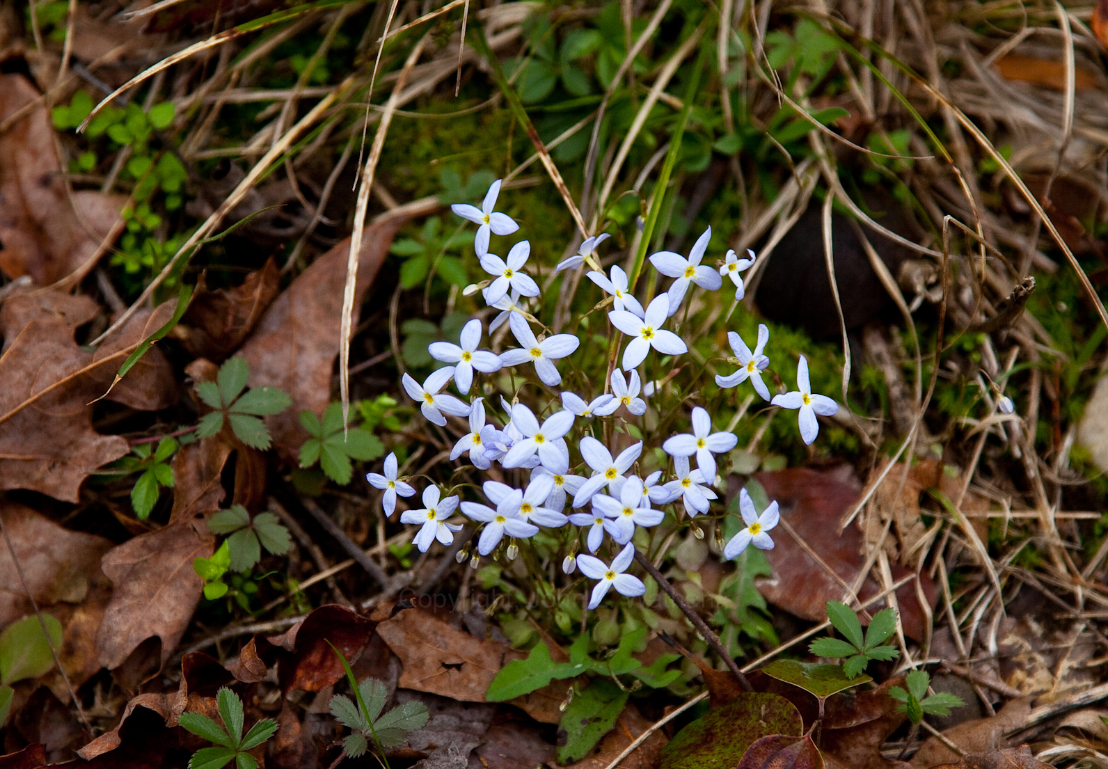
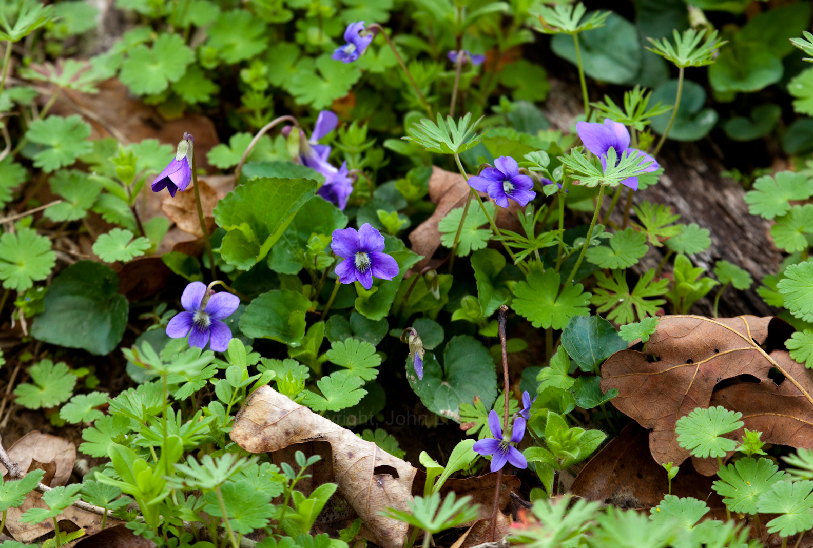
There was an abundance of smaller flowers hidden in the grass and rocks. Some so small you could miss them without noticing how delicate they are by simply living too fast. This Spring, slow down a bit and take time to notice the little things the Creator put here for us to enjoy.


Take care not to disturb them and you should never pick all of the wildflowers out of a patch. You never know what critter may go without. You could also wipe out a patch of flowers by over picking so my motto is take only pictures and leave only tracks.


Some of favorites are getting ready like the wild Alabama Azalea.They are budding out and seem to be really thick throughout. I can hardly wait for them to burst out with that explosion of color Hurricane Creek is noted for.


I hear it raining outside right now. I wonder what my wild berry bushes will look like tomorrow. It's changing that fast. Huckleberries and wild blueberries are putting on flowers so it will not be long before it's feeding time for the birds, chipmunks,and if there's any left over... me.


If you have never had the pleasure of eating Huckleberries straight off of the bush, you are missing a treat. Smaller than a store-bought blueberry but more tasty. A bit more tart and much better for you than the stuff  you can buy in the store. All along the creek huge bushes overhang the water and line the beaches everywhere. Even though they are tiny you can pick gallons of them if you spend a little time slowing down this spring. 


Red Top can be seen covering the entire background


Alabama is known for it's diversity but Hurricane Creek offers a really special collection. From the beginning of Spring when the Red Tops bloom until sometimes as late as June there is a virtual non-stop change of colors. I don't know the genus species name for the tree but I have always called it a Red Top and use to signal the real beginning of the season.


I only have one domestic plant in my yard and it too is an early bloomer. It is a Japanese Magnolia (seen above with the Red Top background) This is the first year it has fully bloomed since the April 27th tornado of 2011. It has struggled but it is a survivor like me I guess.


 Yellow Jasmine hasn't fully opened yet but it should within the next few days.
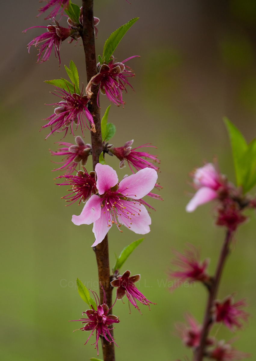
 I walked up the hill to my fruit trees and found them full of blooms and critters. First my peach trees.
If every flower survives without a late freeze I will have a bumper crop of fresh peaches this summer!

When I checked out my apple trees I was also pleased to see how many blooms were on there. These will be my first crop of Red Delicious Apples if they too can survive this Spring.

The bees were doing their part to see that the pollen gets spread. 

              Check out the pollen sacs on this one.


The pear trees were no different. Dripping with flowers and bees making sure things get properly spread around. I'd love to find the hive these bees are feeding!
What a great season to slow down and smell the flowers. Get out this Spring and see some of Alabama's wonderful features. If you are fortunate enough to live close enough to Hurricane Creek Park to get here it will surely be well worth the effort. Dr. E. O. Wilson once said that "for the temperate zone you have to go all the way around the world to find a flora and fauna as diverse as we have right here"
Weed patch??? NO, this is bee food!


Saturday, March 7, 2015

Hurricane Creek Cleanup, 2015

 
-->
Hurricane Creek Cleanup, 2015

                       Great weather, good food, and even better friends and volunteers made. 
the Hurricane Creek cleanup for 2015 a surprising success. 
Todd gives basic paddling instructions
With all of the other activities around town and the state and a sub-freezing start to the day, I wasn’t expecting the number of folks to turn that we got. Not only was there a good turnout but also it was full of young new faces coming for the first time. At the end of the day all said that we could expect to see them back.
Volunteers arrive.

We gathered several truck loads of trash, 1 couch, bags of glass from around the area where our new outdoor classroom is being developed.

22 people floated the creek portion of the cleanup filling all of the boats with everything from kids riding toy cars to garbage bins. This year we went downstream from Watson's Bend to a new takeout located close to the mouth of the creek now thanks to Dr’s Doug and Angela Woodward. Both are fine doctors who love the creek. We will be working with Doug in the near future to create a campground and takeout on his property for Friends of Hurricane Creek. Stay tuned there will be many volunteer projects coming up.


I want to take time to recognize the youth of today that are pouring themselves into the environmental field. I recently attended the annual Alabama Rivers Alliance “Water Rally” where I was pleasantly surprised to see so many young new faces. College clubs are sending whole committees to the conferences and bringing new ideas and energy to the movement. Something us old gray beards are grateful for!
University of Montevallo students at Water Rally
Our cleanup this year was the same. Many new young faces with new ideas for preserving and protecting Hurricane Creek. We had teachers who want to come use the classroom when it’s finished. Scientists who want to do fish surveys for free. Boy Scouts wanting to do projects as well.


2015 is going to be a banner year for Friends of Hurricane Creek and Hurricane Creekkeeper I can feel it! Many thanks to all of the great folks who came out and worked so hard 


 At the end of it we all ate well and had some fun and fellowship.

Friday, March 6, 2015

Study: Excess nutrients affect stream's ecosystem

Study: Excess nutrients affect stream's ecosystem

University of Alabama professor Johnathan Benstead co-authors article in the journal Science


David Manning of the University of Georgia and John Kominoski of Florida International University perform maintenance on research equipment in North Carolina for a study co-authored by Jonathan Benstead, an associate professor of biological sciences at the University of Alabama.
Submitted photo
Published: Thursday, March 5, 2015 at 10:00 p.m.
Last Modified: Thursday, March 5, 2015 at 10:40 p.m.
A study published in the journal Science co-authored by a University of Alabama associate professor reports that nutrient pollution accelerates the breakdown of forest detritus in streams, affecting the food webs in the ecosystems.
“The significance is ... what we are seeing in our experiments is what we are seeing over large parts of the world because of human pollution,” said co-author Jonathan Benstead, an associate professor of biological sciences at UA.
The paper, based on nine years of work between two experiments in forest streams in North Carolina, was published in today’s edition of Science. The work was funded by the National Science Foundation and led by researchers at the University of Georgia.
Forest leaf litter in many streams and rivers is the most important source of energy, Benstead said. Many of the streams are well-shaded by the forest canopy above, limiting photosynthesis and algae growth, another major energy source in streams.
“There are always microbes and animals that make their living by breaking the leaf litter down. That is a very important process in the streams,” Benstead said.
When a leaf falls into a stream, it is quickly colonized by fungi and bacteria that begin the process of breaking it down.
“The microbes actually make it good food for the invertebrates,” Benstead said.
The invertebrates, in turn, become food for other life in the stream.
In the process, the carbon from the litter is exhaled as carbon dioxide by organisms or eventually transported downstream by the current. Carbon in the form of leaf
litter also gets stored longer term in sediments in the streambed, where it continues to break down, Benstead said. 
“The carbon goes somewhere. Either it goes into the atmosphere as carbon dioxide or it goes downstream,” Benstead said.
The rate by which the process occurs is limited by the amount of nitrogen and phosphorus present in the stream. More nitrogen and phosphorus in the system means the process of breaking down the leaf litter is accelerated. The experiments by Benstead and his colleagues sought to mimic the excess nitrogen and phosphorus caused by human impact, such as agriculture and other land uses.
“We were frankly shocked at how quickly leaves disappeared when we added nutrients,” said Amy D. Rosemond, associate professor in the University of Georgia Odum School of Ecology and the study’s lead author. “By summer, the streams looked unnaturally bare.”
Benstead said the acceleration means less carbon is captured locally in the stream, and it is dispersed into the atmosphere and farther downstream faster.
“If you consider leaf litter is the base of the food web, the leaf litter is what all of the insects are feeding on, anything that affects the insects is going to affect things higher in the food web,” Benstead said.
Benstead used the example of insect species that feed on the material during their aquatic larval stages. Some may take a year or two to develop, but the accelerated breakdown of the leaf litter means their food source is exhausted quicker. The acceleration means the material, once reduced to smaller particles, is also transported downstream faster rather than remaining in the streambed near where it entered. 
In natural conditions, the fall leaf fitter remains in the streams until the following summer. But with an accelerated process, it might disappear by late spring, Benstead said.
“The pattern of available food for these things will change greatly if everything disappears faster,” Benstead said.
In the team’s first experiment observing two streams from 1990 to 2005, one was left unaltered and the other had nitrogen and phosphorus added at a set ratio. Researchers observed significant changes in the community of insects. Some species declined, and others did very well under the conditions of nutrient enrichment, Benstead said.
“It’s unlikely that everything will crash, but what you will see is a shift in the populations,” he said.
The researchers observed a species of caddis fly that did very well under enriched conditions as other species suffered, Benstead said.
“That is a nice example of how the effects of nutrient enrichment really can be quite unpredictable,” he said.
The larval stage of the fly protects itself by building a case of small stones and sticks, making it difficult for predators to eat.
“The predators began to suffer because the caddis fly became so dominant,” Benstead said, noting that other species declined.
The researchers conducted their experiments at the Coweeta Hydrological Laboratory, a USDA Forest Service and NSF Long Term Ecological Research site in North Carolina.
The team chose the streams in North Carolina, among other reasons, because they were naturally low in nutrients because of low human impact.
In addition to the 2005 study, the researchers observed five streams from 2010 to 2013 to record the effects of varying the ratios of phosphorus and nitrogen meant to simulate the effects of different land uses.
“We wanted to mimic really what is quite common around the world right now,” Benstead said.
Through its experiments, the team collected the equivalent of roughly 27 years of data on the stream, Benstead said.
“The acceleration of this processing of organic matter we documented by adding nutrients is occurring now all over the world because of human pollution,” Benstead said.
Benstead said the experiments in North Carolina are complete and that the researchers are working on other papers based on their findings.
Benstead and Rosemond’s co-authors are research coordinator Phillip M. Bumpers, graduate student David W.P. Manning and professors emeritus J. Bruce Wallace at UGA’s Odum School of Ecology, UA professor emeritus Keller Suberkropp, associate professor Vladislav Gulis of Coastal Carolina University and assistant professor John S. Kominoski of Florida International University.
Reach Ed Enoch at ed.enoch@tuscaloosanews.com or 205-722-0209.


Thursday, February 19, 2015

GUEST COLUMN | Eastern Bypass makes no sense

Eastern Bypass plan is archaic and doesn't fit with Tuscaloosa's sustainable plan for area's future


Published: Sunday, May 6, 2012 at 3:30 a.m.
Last Modified: Saturday, May 5, 2012 at 11:53 p.m.
TUSCALOOSA | In the wake of last year's tornadoes, the Friends of Hurricane Creek ask our local leaders to plan with consideration of the importance of our existing neighborhoods, community bonds and wild, natural areas rather than an outdated definition of “growth” as bases for our city's future. We are inspired and encouraged by the forward thinking represented by the planning efforts that have taken place since 2011's devastation, and we look forward to that type of planning being implemented throughout the city and county.
Unfortunately, a fossil stands in our way. Known as the Eastern Bypass, this relic is a dated creation of the past century that is still being taken seriously. The bypass is a model for sprawl and decentralization; for increased reliance upon the personal automobile resulting in more pollution and numerous other well-documented side effects.
The Tuscaloosa Forward plan, on the other hand, is a model for planning healthy, safe, accessible, connected and sustainable communities.
The disconnect between the Tuscaloosa Forward plan and the Eastern Bypass plan to move some parts of Tuscaloosa backward is too large to ignore.
The Alabama Department of Transportation has concluded that the best route for the bypass is through the heart of Hurricane Creek Park's unique M-Bend area. It crosses the creek twice in the M-Bend with a total of five bridges (refer to the 1998 Environmental Impact Statement or “EIS”).
This continues to be the official position, even though this route will irreversibly damage a public park, displace hundreds of local residents — many of whom were impacted by the 2011 tornadoes — drastically alter noise and pollution levels, permanently divide communities and possibly even impact the flow and health of Hurricane Creek itself.
The half-hearted process by which
ALDOT has “engaged” the community on this massive and costly project suggests that some would prefer to keep the public uninformed. For example, the EIS — the document which purports to analyze the available routes and justify the one chosen — was not available online for 14 years. It was made available within the past month only after a private citizen, a local mother of three, contacted the Federal Highway Administration and questioned the legality of not having it available.
ALDOT has held several “public forums,” the past two of which were scheduled during Christmas and spring breaks, respectively.
At the “forums” the information was presented in such an arcane, disjointed way that even the few community members in attendance continue to be confused about the exact location, impact and purpose of the Eastern Bypass.
Most other states attempting such vast transportation projects maintain Web sites with extensive information, maps and updates for the taxpayers who fund them. ALDOT does not.
Given the lukewarm attempts to inform and educate the public to date, we have little hope that ALDOT will change tactics when this bypass is actually being built.
In addition to the changes brought by the passage of time since the 1998 route decision, two major changes have occurred which cannot be ignored. These changes have rendered stale and irrelevant those portions of the Environmental Impact Statement which pertain to segments of the bypass in the Hurricane Creek area.
A 249-acre public park was established by the Tuscaloosa Parks and Recreation Authority for the specific purpose of providing a natural outdoor experience for the public and for protecting the spectacular M-Bend.
How can families enjoy the outdoors while trucks and traffic from a 4-lane highway whizz overhead? Imagining that you can have both a bypass and a natural park is the kind of dangerous wishful thinking that will turn the bypass, a transportation relic, into backward reality.
Another game-changer was the 2011 tornado, which destroyed countless acres of mixed woodlands and removed shady creek cover from two linear miles of the stream past the Holt-Peterson Bridge over Hurricane Creek. 
Natural conditions have been altered to such a degree that the analyses in the 14-year-old EIS are no longer applicable and must be re-done.
The current route disproportionately affects lower-income residents of Tuscaloosa County, while positive benefits tend to accrue for higher-income residents of the area north of the river, a situation which generates hostility and a sense of division.
The fact that some must be “wronged” by a project which purports to be a tool for “economic development” is ironic and difficult to stomach.
The fact that those recently traumatized by the tornado are next in line to be traumatized by the bypass verges on the tragic.
This part of the city, especially the Holt and Cottondale communities, will resemble the least appealing parts of Atlanta, where continuous traffic, noise pollution and automotive exhaust characterize the milieu.
In addition, the families visiting loved ones buried at Memorial Park will have to contend with their new status as scenery for a regional truck route.
Hurricane Creek has long been used for swimming, boating and fishing by local residents.
It also has a powerful historical value for local residents who refer to its peace and tranquility as a “treasure unique to our state.”
Turning the creek watershed into a trucking route will undoubtedly affect its status as a local recreational treasure enjoyed by residents who may not be able to afford more costly sources of recreation.
Our leaders have committed to a green recovery and a Tuscaloosa that moves “forward,” which requires letting go of the fossil.
Let's make sure that the Holt, Cottondale and East Tuscaloosa's communities and environment are included in this goal for healthy, connected, sustainable and naturally beautiful areas. 
Laurie Johns is the president and Alina Coryell is a board member of The Friends of Hurricane Creek, a 501c3 organization dedicated to education, recreation, and preservation of the Hurricane Creek watershed and its tributaries. Readers can visit their web site at www.hurricane-
creek.org,


Tuscaloosa City Council OKs 640-home residential project

Developer, planners say project will have only minimal traffic impact


Published: Tuesday, December 16, 2014 at 11:00 p.m.
Last Modified: Tuesday, December 16, 2014 at 11:09 p.m.
A new 282-acre subdivision in north Tuscaloosa was given unanimous approval Tuesday night by the City Council.
Estimated at $20 million before the construction of the planned 640 single-family homes and 18 townhouses, its completion is expected to take between 10 and 15 years.
Dubbed “Highgrove” by developers Warrior Property Holding LLC, the proposed development is located west of Rice Mine Road Northeast and adjacent to Munny Sokol Park and the Townes of North River subdivision.
The homes will be built in phases and range in value from $300,000 to $1 million, and the development also features 48 acres of open space, walking trails connecting to the Townes of North River and an area for future commercial development.
The council voted to accept not only the planned unit development of Highgrove but also the rezoning of a 3.4-acre tract to allow businesses to operate near the subdivision’s main entrance. Another feature of the development is a small portion in its northeast quadrant set aside for a new fire station.
City officials stress that no fire station is planned for this area of the city, but the space is available in case one is needed here.
“The issue was raised that, one day, there may be a need for an additional fire station,” said Councilwoman Cynthia Almond, who represents this area as part of District 3.
Michael W. Gardiner, a project manager for the McGiffert and Associates engineering firm, represented Warrior Property Holding before the council. He concurred with Almond’s assessment.
“They’re just reserving an area for a fire station if the city elects to build one,” Gardiner said, adding that the area set aside for the fire station is not set to be developed for another eight to 10 years.
Gardiner showed a site plan with four commercial buildings surrounding an interior parking lot just inside the development’s main entrance.
However, no businesses are currently slated to occupy these spaces, and the developers have not identified what kind of shops would be preferred.
“We don’t know at this point in time,” Gardiner said.
For its first phase, set to begin construction in spring 2015 with completion later that year, the developers are proposing the construction of 144 of the residential lots.
While the council’s vote on the Highgrove planned unit development and rezoning request for a small portion of the lot each followed scheduled public hearings, no one spoke out for or against the project.
This came as a surprise to Councilman Eddie Pugh, who expected someone to lament the additional traffic brought by the development.
“I can’t believe someone’s not up here commenting about traffic,” Pugh said.
His comment again brought Gardiner to the podium to address Pugh’s questions. The engineer said a traffic study performed by Skipper Consulting showed there would be no adverse effect on Rice Mine Road travelers because of the planned addition of turning lanes into two of Highgrove’s three entrances.
This was supported by John McConnell, director of the city’s Department of Planning and Development Services, who said traffic increases on Rice Mine and New Watermelon roads are not expected to be an issue.
One possible reason for this is that, with the open space, the average dwelling unit per acre total is at 2.3 for the Highgrove development. Normally, housing developments under the R-1 zoning, which Highgrove falls under, is at 4 units per acre.
“This is a very low-density development,” McConnell said.
Reach Jason Morton at jason.morton@tuscaloosanews.com or 205-722-0200.