Thursday, February 19, 2015

GUEST COLUMN | Eastern Bypass makes no sense

Eastern Bypass plan is archaic and doesn't fit with Tuscaloosa's sustainable plan for area's future


Published: Sunday, May 6, 2012 at 3:30 a.m.
Last Modified: Saturday, May 5, 2012 at 11:53 p.m.
TUSCALOOSA | In the wake of last year's tornadoes, the Friends of Hurricane Creek ask our local leaders to plan with consideration of the importance of our existing neighborhoods, community bonds and wild, natural areas rather than an outdated definition of “growth” as bases for our city's future. We are inspired and encouraged by the forward thinking represented by the planning efforts that have taken place since 2011's devastation, and we look forward to that type of planning being implemented throughout the city and county.
Unfortunately, a fossil stands in our way. Known as the Eastern Bypass, this relic is a dated creation of the past century that is still being taken seriously. The bypass is a model for sprawl and decentralization; for increased reliance upon the personal automobile resulting in more pollution and numerous other well-documented side effects.
The Tuscaloosa Forward plan, on the other hand, is a model for planning healthy, safe, accessible, connected and sustainable communities.
The disconnect between the Tuscaloosa Forward plan and the Eastern Bypass plan to move some parts of Tuscaloosa backward is too large to ignore.
The Alabama Department of Transportation has concluded that the best route for the bypass is through the heart of Hurricane Creek Park's unique M-Bend area. It crosses the creek twice in the M-Bend with a total of five bridges (refer to the 1998 Environmental Impact Statement or “EIS”).
This continues to be the official position, even though this route will irreversibly damage a public park, displace hundreds of local residents — many of whom were impacted by the 2011 tornadoes — drastically alter noise and pollution levels, permanently divide communities and possibly even impact the flow and health of Hurricane Creek itself.
The half-hearted process by which
ALDOT has “engaged” the community on this massive and costly project suggests that some would prefer to keep the public uninformed. For example, the EIS — the document which purports to analyze the available routes and justify the one chosen — was not available online for 14 years. It was made available within the past month only after a private citizen, a local mother of three, contacted the Federal Highway Administration and questioned the legality of not having it available.
ALDOT has held several “public forums,” the past two of which were scheduled during Christmas and spring breaks, respectively.
At the “forums” the information was presented in such an arcane, disjointed way that even the few community members in attendance continue to be confused about the exact location, impact and purpose of the Eastern Bypass.
Most other states attempting such vast transportation projects maintain Web sites with extensive information, maps and updates for the taxpayers who fund them. ALDOT does not.
Given the lukewarm attempts to inform and educate the public to date, we have little hope that ALDOT will change tactics when this bypass is actually being built.
In addition to the changes brought by the passage of time since the 1998 route decision, two major changes have occurred which cannot be ignored. These changes have rendered stale and irrelevant those portions of the Environmental Impact Statement which pertain to segments of the bypass in the Hurricane Creek area.
A 249-acre public park was established by the Tuscaloosa Parks and Recreation Authority for the specific purpose of providing a natural outdoor experience for the public and for protecting the spectacular M-Bend.
How can families enjoy the outdoors while trucks and traffic from a 4-lane highway whizz overhead? Imagining that you can have both a bypass and a natural park is the kind of dangerous wishful thinking that will turn the bypass, a transportation relic, into backward reality.
Another game-changer was the 2011 tornado, which destroyed countless acres of mixed woodlands and removed shady creek cover from two linear miles of the stream past the Holt-Peterson Bridge over Hurricane Creek. 
Natural conditions have been altered to such a degree that the analyses in the 14-year-old EIS are no longer applicable and must be re-done.
The current route disproportionately affects lower-income residents of Tuscaloosa County, while positive benefits tend to accrue for higher-income residents of the area north of the river, a situation which generates hostility and a sense of division.
The fact that some must be “wronged” by a project which purports to be a tool for “economic development” is ironic and difficult to stomach.
The fact that those recently traumatized by the tornado are next in line to be traumatized by the bypass verges on the tragic.
This part of the city, especially the Holt and Cottondale communities, will resemble the least appealing parts of Atlanta, where continuous traffic, noise pollution and automotive exhaust characterize the milieu.
In addition, the families visiting loved ones buried at Memorial Park will have to contend with their new status as scenery for a regional truck route.
Hurricane Creek has long been used for swimming, boating and fishing by local residents.
It also has a powerful historical value for local residents who refer to its peace and tranquility as a “treasure unique to our state.”
Turning the creek watershed into a trucking route will undoubtedly affect its status as a local recreational treasure enjoyed by residents who may not be able to afford more costly sources of recreation.
Our leaders have committed to a green recovery and a Tuscaloosa that moves “forward,” which requires letting go of the fossil.
Let's make sure that the Holt, Cottondale and East Tuscaloosa's communities and environment are included in this goal for healthy, connected, sustainable and naturally beautiful areas. 
Laurie Johns is the president and Alina Coryell is a board member of The Friends of Hurricane Creek, a 501c3 organization dedicated to education, recreation, and preservation of the Hurricane Creek watershed and its tributaries. Readers can visit their web site at www.hurricane-
creek.org,


Tuscaloosa City Council OKs 640-home residential project

Developer, planners say project will have only minimal traffic impact


Published: Tuesday, December 16, 2014 at 11:00 p.m.
Last Modified: Tuesday, December 16, 2014 at 11:09 p.m.
A new 282-acre subdivision in north Tuscaloosa was given unanimous approval Tuesday night by the City Council.
Estimated at $20 million before the construction of the planned 640 single-family homes and 18 townhouses, its completion is expected to take between 10 and 15 years.
Dubbed “Highgrove” by developers Warrior Property Holding LLC, the proposed development is located west of Rice Mine Road Northeast and adjacent to Munny Sokol Park and the Townes of North River subdivision.
The homes will be built in phases and range in value from $300,000 to $1 million, and the development also features 48 acres of open space, walking trails connecting to the Townes of North River and an area for future commercial development.
The council voted to accept not only the planned unit development of Highgrove but also the rezoning of a 3.4-acre tract to allow businesses to operate near the subdivision’s main entrance. Another feature of the development is a small portion in its northeast quadrant set aside for a new fire station.
City officials stress that no fire station is planned for this area of the city, but the space is available in case one is needed here.
“The issue was raised that, one day, there may be a need for an additional fire station,” said Councilwoman Cynthia Almond, who represents this area as part of District 3.
Michael W. Gardiner, a project manager for the McGiffert and Associates engineering firm, represented Warrior Property Holding before the council. He concurred with Almond’s assessment.
“They’re just reserving an area for a fire station if the city elects to build one,” Gardiner said, adding that the area set aside for the fire station is not set to be developed for another eight to 10 years.
Gardiner showed a site plan with four commercial buildings surrounding an interior parking lot just inside the development’s main entrance.
However, no businesses are currently slated to occupy these spaces, and the developers have not identified what kind of shops would be preferred.
“We don’t know at this point in time,” Gardiner said.
For its first phase, set to begin construction in spring 2015 with completion later that year, the developers are proposing the construction of 144 of the residential lots.
While the council’s vote on the Highgrove planned unit development and rezoning request for a small portion of the lot each followed scheduled public hearings, no one spoke out for or against the project.
This came as a surprise to Councilman Eddie Pugh, who expected someone to lament the additional traffic brought by the development.
“I can’t believe someone’s not up here commenting about traffic,” Pugh said.
His comment again brought Gardiner to the podium to address Pugh’s questions. The engineer said a traffic study performed by Skipper Consulting showed there would be no adverse effect on Rice Mine Road travelers because of the planned addition of turning lanes into two of Highgrove’s three entrances.
This was supported by John McConnell, director of the city’s Department of Planning and Development Services, who said traffic increases on Rice Mine and New Watermelon roads are not expected to be an issue.
One possible reason for this is that, with the open space, the average dwelling unit per acre total is at 2.3 for the Highgrove development. Normally, housing developments under the R-1 zoning, which Highgrove falls under, is at 4 units per acre.
“This is a very low-density development,” McConnell said.
Reach Jason Morton at jason.morton@tuscaloosanews.com or 205-722-0200.


Tuesday, November 11, 2014

Local Color

 Local Color

Frances Drennen co-owner Manna Grocery and John L. Wathen, Hurricane Creekkeeper

A collection of photo prints by John L. Wathen.

All photos, and framing are creations from the area’s scenic places and history. The frames are all handmade by John using repurposed wood from the tornado that struck Tuscaloosa and Holt area on April 27, 2011. Using a portable sawmill and select logs, the more interesting wood found in the local area was used. Many of which most people have never seen.

About the Prints

“Foggy Dog” was taken on Hurricane Creek in early fall.
“The Bridges” was taken from the downstream angle of the old railroad bridge and the Lurleen Wallace Bridge. A Parker Towing vessel is seen maneuvering the spans.
Foggy Dog, top  The Bridges, bottom
 “Fall Sunrise” was taken in the heart of what is known as the “M” band of Hurricane Creek (upper left)
 “Misty Shoals” is in the upper section of Hurricane Creek, known as the low water crossing.
(upper middle)
“Marshall Presley Falls” was taken in the lower section of Hurricane Creek on the Marshall property. Jack Marshall was a good friend of Elvis Presley. While playing a concert in Tuscaloosa Elvis actually came to the property for a visit and helped stack some of the rocks to make this man-made fall. (or so the story goes)
(upper right)


 “T’town Sunset” was taken at the Manderson Landing park looking south.
“Bama Belle” was taken in the Black Warrior River of the excursion boat Bama Belle.

“Walking Heron” was taken at the mouth of Hurricane Creek where it joins the Black Warrior River.
“American Kestrel / Legacy” is a bird at the Alabama Wildlife Center.  His name is Legacy. He was born with deformed talons making it impossible to hunt adequately so he has been glove trained for education purposes.No matter where you stand in the room, his eyes follow you.


 About the frames:
The lighter colored, with dark black streaks are “spalted Poplar”
Spalting is any form of wood coloration caused by fungi.

The lighter brown colored frame around “Foggy Dog” is Mountain Oak, rarely milled today.

The frames around both bird prints are Eastern Red Cedar.

The frame around “Bama Belle” is Red Oak.
Most of these trees were blown down in the tornado of April 27, 2011 and would have gone to the landfill if not for the Friends of Hurricane Creek and their successful mission of repurposing every stick of wood downed by the tornado.

The dark colored rough-cut frames around “The Bridges” and “T’town Sunset” are recycled Cherry barn wood.

Prices

All large prints are $400.00 each

The 2 smaller prints are $250.00 each

For more information, contact
John L. Wathen
205-310-3739
On Facebook, John Wathen

Manna Grocery and Deli
2300 McFarland Blvd. E.

Suite 12

Tuscaloosa, AL 35404

Phone:  (205) 752-9955

Thursday, August 28, 2014

Environmental Injustice In Perry County


PCA Landfill 07/13/09
 (click to enlarge then
top right hand corner to return to story)


  Environmental Injustice In Perry County

51 years ago today Dr. Martin Luther King gave his infamous, "I have a dream" speech. Unfortunately that dream is more like a nightmare for the people of South Perry Co. Alabama.

To say that the PCA landfill in Perry County Alabama has improved since I first saw it would be an accurate statement on the surface. It doesn't mean the long range impacts have gone away. (click to enlarge. Upper right "X" to return to story)

The first aerial photo, courtesy of SouthWings was taken 07/13/09 and the second almost exactly 5 years later. All of the black mountain you see in the first shot is coal ash dumped here from the Kingston Tn. coal ash disaster in the Clinch and Emory Rivers. It was brought to Perry County in "burrito" bags to keep it from blowing dust into the white affluent community of Swan Pond and Kingston Tn. Basically it was treated like a hazardous material. 


Coal ash from Kingston Tenn. in dust proof "Burrito bags"
Of course that wasn't the way it was treated on arrival at the Uniontown terminal at PCA landfill.On Arrival it was unceremoniously ripped out of the bags, dumped on the ground directly over a culvert to Tayloe Creek, and then to cleanse the cars for the long trip back to Kingston they intentionally used several high pressure fire hoses to wash the coal ash into the tributary of Tayloe Creek.
Unloading facility
Unloading and washout

Wetland downgrade from the washout facility.
Catfish farms downstream from PCA landfill (Eat more catfish)
 This was at the peak of shipments from Tenn. The ash was so wet because it had to be dredged out of the river. 

Being full of river water when it arrived in Perry Co. created special problems of it's own. South Perry County is located on top of what is known as the Selma Chalk layer.

This formation is a type of soft rock type material not given to percolation. Water discharged to the surface tends to stand and puddle rather that soak into the earth. With the additional moisture from the ash and poor soil quality it caused an inordinate amount of toxic leachate to be present in the landfill. Wiki has this to say about leachate...

Environmental impact (WIKI)

"The risks from waste leachate are due to its high organic contaminant concentrations and high concentration of ammonia. Pathogenic microorganisms that might be present in it are often cited as the most important, but pathogenic organism counts reduce rapidly with time in the landfill, so this only applies to the most fresh leachate. Toxic substances may however be present in variable concentration and their presence is related to the nature of waste deposited."

In Perry County they were dumping toxic Arsenic laced coal ash and mixing it with household garbage. The leachate produced was not only high in Ammonia but added toxins from the coal ash, Arsenic, made this a cocktail of the most nasty smelling and nauseating substance I have ever encountered. I caught the landfill pumping toxic leachate out of the landfill at night.


Recently I had the opportunity to fly over the area with SouthWings once again. Along with observing the landfill I was asked by locals to document conditions at the Southeastern Cheese plant and an alleged failing sewage "spray field" operated by Uniontown Alabama.
Note the mold looking substance growing on the sign! Copyright JLW, all rights reserved
If you have never been around a cheese plant, you can't possibly imagine the stench and filth associated with one. The stream leading away from Southeastern to a small creek suprised even me!

 It was boiling with something I had never seen. Toxic is a word that doesn't pay justice to the smell and appearance of this particular tributary. I was told about how bad it was but until I saw and smelled it up front I couldn't grasp the impact. The water was boiling with septic bubbles that indicate a severe problem. Where is ADEM?

tributary immediately downstream from Southeastern Cheese.
Maybe they are different in other places but here it is what I saw that is overseen by ADEM (Alabama Department of Environmental Maniacs) In this photo (below) you are looking at the waste processing area where whey is pumped into open lagoons.
The white / brownish looking pond is full of what amounts to rotted buttermilk (whey).  I am told that it is circulated to keep it liquid and flowing so it can be "processed" by the remaining segments of the treatment area.
As you can see there isn't much in the way of treatment going on.
One pond looks and smells as bad as another.
Permitted ADEM point of discharge is in the lower right corner.
After "treatment" in the ponds the effluent water is sprayed in fields surrounding the ponds. Again, the stench of this is almost unbearable. I couldn't imagine what the poor folks living around it have to endure on a daily basis.
Note the cattle grazing in the upper section right next to spray fields. (EAT MORE BEEF)
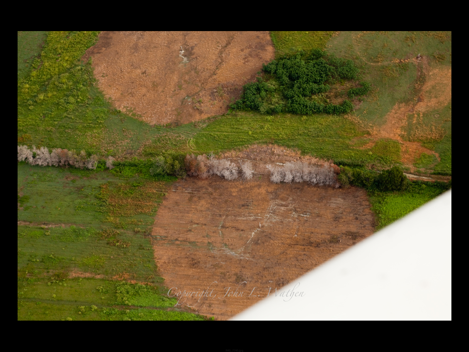
I saw gray looking semicircles along the tree lines. That is where the effluent is killing the trees. The "Final effluent discharge" is sprayed. Look at the dead semicircle lines in the trees and then look how close to where the cows are grazing. 
Note cows grazing in upper left (Eat more beef)


If this were in a completely rural area it might be different. It isn't! Directly across from the "waste treatment" spray fields at Southeastern Cheese is a heavily populated subdivision. Can you imagine what it must be like living that close to ponds full of rotten milk?! 
 
After being thoroughly sickened with the cheese plant we flew to the sewer "spray fields". All of the waste effluent water  is sprayed out and absorbed into the ground for final treatment according to ADEM . The problem with that is that South Perry County lies above the "Selma Chalk". This presents problems for home foundations. Septic tank filter fields may need special attention because formation of the soils percolate water very slowly. However, the soils are very good for small pond This is a semi-hard rock formation that doesn't lend itself to percolation which is what a spray field needs to function adequately. (WIKI) What I saw was a miserable failure at best. ADEM (Peppie Lance R. LeFleur, DIRECTOR) has been aware of the chronic nature of this situation but has neglected to take action for many years. It wasn't until after threats of lawsuits did ADEM take action. Even then it was a joke called enforcement. Here is the "spray field" from a SouthWings plane. 
Spray fields are designed to perk into the soil. No water should ever be seen standing in a treatment area.
The nasty green looking mass in the upper left of the field is standing putrid water. The circles are where the effluent should have been absorbed into the ground. Obviously it didn't work. 
Spray heads are center of the dead zones. (right) The lagoon in the upper left should be dry.
How would you like to live there?! I saw 14 spray heads in service
ADEM did take action. They made Uniontown build a new processing plant AND or repair the existing system. Over 2 Million dollars was given to Uniontown to "fix" the problem. They drew up plans for a new treatment facility using the old method of failure as a remedy. Einstein said the definition of insanity is... "doing the same thing over and over and expecting a different result." ADEM is a prime example of that insanity definition. My personnel opinion is this... ADEM should be there to review and decline  permits known to fail. The NEW AND IMPROVED solution was a duplicate  a failure of the past. Here is the "new" spray field. No spray heads have been installed but there is already water standing in the "spray field"(Rhutt Rhow)
 When asked about permitting such a fiasco, Scott Hughes (ADEM) had this to say to Adam Johnstom (ARA) ... We don't review permits for engineering. We issue permits if the local host government approves the design. If a local host approves the design we issue the permit. (paraphrase) What nonsense Scott?! If ADEM isn't supposed to enforce the Clean Water Act, designed to protect downstream citizens from negative impacts of pollution, then stop taking my tax money!

After leaving this last ADEM permit failure we flew over downtown Uniontown. I really think that is when it really sank in just how big a problem environmental injustice had become for this community. I played for Cold Steele, a rock band, in the 90"s I played Uniontown. It wasn't the biggest gig we did but it was at least a thriving town then, back in 1993. "The Club" where we played can be seen in the middle of town with the roof laying on the floor.
What has happened to Uniontown?
Simple... Cumulative impacts of environmental injustice at the hands of greedy corporations who came to Perry County to exploit the lack of state enforcement and the  low income, poverty stricken, people of color which didn't stand a chance against the corporate greed and lack of oversight by ADEM. It was, after all, ADEM who was charged with the so-called protection from such environmental injustice seen here today.

Shame on you ADEM!


Sunday, June 29, 2014

OPINION:

 Residents don’t need more landfill traffic


Tuscaloosa News Editorial 
Published: Saturday, June 28, 2014 at 6:00 p.m.
Last Modified: Friday, June 27, 2014 at 6:50 p.m.
It’s not surprising that the Tuscaloosa County Commission didn’t immediately make a decision with regard to allowing Eagle Bluff Landfill in Holt to triple the amount of debris that it’s taking in. Competing interests make the decision a very difficult one.

The owners say demand for the landfill’s services jumped dramatically with the April 2011 tornadoes. That’s not surprising given the amount of destruction throughout the city. Once all of that debris is scooped up and loaded into the back of a dump truck, it has to go somewhere. But it is surprising that more than three years after the storms, the demand hasn’t subsided.

All construction creates debris, and there is plenty of construction underway in Tuscaloosa County. Much of it is only tangentially related to the storms now, as most of the clearing and replacement are complete. Construction continues in some of the area where the tornado struck, but it’s also going on elsewhere.

The boom in student housing may have more to do with current demand for landfill space than tornado cleanup. How much longer that boom will continue, we can’t say. But we doubt that landfill space will be the determining factor.

Landfills really don’t belong in the middle of residential neighborhoods. If Holt was within an incorporated municipality, Eagle Bluff probably wouldn’t be there. That’s one of the paradoxes of unincorporated urbanized areas.

However, the landfill is located in a residential area and has been for more than two decades. The people living near it aren’t asking the County Commission to close the landfill, just to maintain the current cap of 1,000 cubic yards a day.

Most of the problems arise more from the traffic to the landfill than from the landfill itself. As the owners point out, this is a construction debris landfill, not one for household garbage. For the most part, it isn’t creating foul odors or attracting vermin.

However, the trucks loaded with debris do create problems with mud and dust. It’s difficult to drive on and off construction sites without getting muddy. That’s just the nature of construction.
And some of what the trucks carry creates dust as well. Trucks tracking mud and dirt onto small, residential streets is bound to create dust problems for residents.

Residents would likely look more favorably on the landfill capacity expansion if the trucks loaded with debris weren’t rumbling down their neighborhood streets. We can’t argue with trucks using Crescent Ridge Road, a major thoroughfare. But the neighborhood streets accessing the landfill aren’t really appropriate for truck traffic.

The owners say there isn’t a way to build alternative access to the landfill. Given that, it would seem unwise to increase the amount of debris the landfill can accept daily and thus, the number of trucks carrying it through residential streets.


Sunday, June 22, 2014

Advanced Disposal Landfill... Public Nuisance

Public Nuisance 

By John L. Wathen


Advanced Disposal Landfill / public nuisance
A hearing will take place Wed. June 25th in conjunction with the Tuscaloosa County Commission's normally scheduled Commission meeting in the Commission Chambers at the Tuscaloosa County Courthouse.

The hearing is to address the request by Advanced Disposal Landfill in Holt to increase the waste load entering the landfill by 3 times. To-date, they are allowed to accept 1,000 cubic yards per day. They are requesting an increase to 3,000 cubic yards per day.

If this were a remote location with little residential contact I wouldn’t have a problem but this isn’t the case. Crescent Ridge Road in Holt is the direct path for every trash truck entering the landfill. All turn onto 12th street that is barely wide enough for 2 cars, let alone scores of huge trucks. These are not little pickup trucks with a load of leaves. They are large trucks with trash bins carrying many yards of debris from current construction as well as demolition of buildings. Some built long ago when asbestos and lead based paints were used.

If these things were covered properly and not tracked back into the community there would be less reason for concern. That isn’t the case either.
Advanced Disposal "Mt. Trashkaloosa" seen from Holt Peterson Rd. 03/13/14
The landfill has grown tremendously over the years to a mountain of garbage known to us here as Mt. Traskaloosa. Since 2006, I have documented thousands of potential violations of the Clean Water Act, which were reported to the Alabama Dep. of Environmental Management (ADEM) time after time. ADEM, as usual, has chosen to ignore the chronic nature of the violations and taken no action to curb the ongoing problems.
Landfill discharge to Hurricane Creek
The height of Mt. Traskaloosa makes it an eyesore from all over the community. Bright orange dirt piles resembling scars on the earth, uncovered for weeks on end with blowing garbage. Large sheets of plastic sheeting have been video taped leaving the fill and landing over 100 yards on private lands. Neighbors constantly complain of trash blowing in their yards and into Hurricane Creek. Dust laced with fiberglass insulation and many other dangerous particles are seen regularly spreading across the area. Holt Elementary School is a scant 1,500 feet from the landfill.
ADLF aerial view. Flight provided by SouthWings
ADLF dust and wind blown trash
If the dust created by the mountain of trash weren’t bad enough, the huge trucks entering and leaving the landfill track vast amounts of mud onto 12th street which creates environmental issues for Hurricane Creek, Unsafe driving conditions on 12th street, but more importantly, it creates health and safety issues for the community.

When the mud dries, it becomes a dust cloud that is within 20 to 30 feet from residences. In one case, the road is just 15 feet from a person’s living and dining room. The trucks are driving through all sorts of debris containing solvents, adhesives, old carpet, concrete dust and rubble, paint, and sheetrock debris, plus many more things people are not supposed to breathe on a concentrated level.

The residents along 12th street literally have to stand in the street to check the mailbox. When the trucks became a problem due to congestion, the past County Commission made the problem worse by paving the street wider. Now some of the mailboxes are actually hanging over the pavement making for extremely dangerous living conditions.
Trash truck on 12th street
Big trucks, Little cars, Narrow streets = unsafe driving conditions
Hundreds of photo-documented events have been sent to ADEM with no deterrent action taken since as far back as 2006. Many are a matter of record at ADEM and can be accessed online, however their records do not reflect all of the complaints do to changes in owners.

When the landfill was installed many years ago, it was a small hole in the ground and meant to be used for construction and demolition debris (C&D). When locally operated the landfill there was a better sense of community effort on his part to work with the people impacted. If there were issues, I am told they worked them out as a good neighbor would. After they sold the property to an out of state company it changed, much for the worse.

With each change of hands over the years it has grown to be a substantial nuisance to the community. The current owners, Advanced Disposal are my opinion the worst yet.

I met with a representative of the landfill in June of last year by accident and told him of my intentions to file a complaint if conditions didn’t improve. I was met with a friendly invitation from officials in Florida to work with them to address the issues I had. Later, after several friendly email and phone conversations, I met them unexpectedly around the landfill property the local manager of the facility met me with aggression and threats. I was later served with a trespass notice. That’s not how good neighbors work together.

ADEM did step in with a notice of violation in Nov. 2013, which still today hasn’t been enforced. Every complaint sent to ADEM was forwarded to the landfill to evaluate and make excuses for their chronic problems. Some have been addressed but many, such as the offsite tracking are still as bad as ever.

Street sweepers normally used for litter are used to sweep the mud into the ditches and drainage's along 12th street. Since none of the machinery used was designed to pick the mud up, it only spreads much of it into a fine particulate dust that stays in the air long after the huge trucks stir it up. Using a time-lapse camera on Feb 17, 2014, I documented as many as 73 big trucks in a matter of just 2 hrs, 42 minutes. That comes to roughly 1 truck every 2.2 minutes.

According to a recent Tuscaloosa County Engineers traffic count that number was overwhelmingly proven.
In 1 week the actual count was as follows:

The average daily traffic for the week is 240 vehicles per day

A total of 1675 vehicles were counted for the 7 day study

Looking at the hours from 5:00 am to 10:00 pm only,  the average daily for that range is 234 vehicles per day

A total of 1634 vehicles were counted for the week using that range of hours.

Those same trucks track mud and dust onto graves in the Chambers Cemetery. The cemetery long pre-dates the landfill but no one seems to care except the ones who have family there. Funerals have been interrupted, dusted, and literally blocked in by trash trucks. Some drivers even blow the horn when they pass people there with no respect for the living or the dead.
Grave next to 12th street, just outside Advanced Disposal Landfill
June 11, 2014
Now, remember the reason for this letter. They can’t control the problems at 1,000 cubic feet per day. How is it that anyone in authority can think it will get better with an increase of three times the waste on this tiny residential street? Instead of 234 vehicles per day, imagine 700 vehicles per day, or more than 1 per minute rolling right outside your living room window.

Please consider attending the County Commission Meeting on June 25thth at 9 AM in the Commission Chambers at the Tuscaloosa County Courthouse to voice your concerns for this increase that will certainly have a more negative impact than ever.

If we are to ever grow Holt into a thriving community after the Apr. 27th 2011 tornado, it shouldn’t be with Mt. Trashkaloosa as the main attraction.

Mt. Trashkaloosa, Advanced Disposal Landfill. (Flight provided by SouthWings)
Check out the video below to get a feeling of what it's like living next to a public nuisance in many opinions around the Holt Community

Holt landfill operator seeks to triple capacity

Nearby residents oppose request, citing traffic, safety


Landfill
Landfill (From Tuscaloosa News)
A Rumsey Environmental waste truck makes it's way down 12th Street toward the Eagle Bluff Landfill to dump a load of debris on Wednesday June 18, 2014. Advanced Disposal has proposed a volume increase for the landfill from 1000 yards of construction debris a day up to 3000 yards per day. The Eagle Landing landfill receives debris from the city's of Northport and Tuscaloosa, the Tuscaloosa Department of Transportation, and the Alabama Department of Transportation. The Tuscaloosa News | Erin Nelson
Tuscaloosa News
Published: Saturday, June 21, 2014 at 10:00 p.m.
Last Modified: Saturday, June 21, 2014 at 11:04 p.m.
The owners of a construction and demolition landfill in Holt are seeking approval from the Tuscaloosa County Commission to triple the amount of debris that can be brought in each day.
Local residents aren't happy about the request. The only way in and out of the dump is a two-lane residential road — 12th Street Northeast — lined by small homes and trailers.
“It's enough as it is, with trucks coming in and out too fast throughout the day,” said resident Crystal Curry, while her young daughter played on a scooter in the yard.
Advanced Disposal, which owns the Eagle Bluff landfill, has requested a modification of its permit to increase the intake at the landfill from 1,000 yards of construction and demolition debris a day to 3,000 yards per day.
The reason for the request is the huge demand with all the demolition and construction projects going on in Tuscaloosa, said Mary O'Brien, chief marketing officer for Advanced Disposal. There are only two landfills specifically for construction debris in Tuscaloosa County.
“Luckily for Alabama, the economy is coming back, and there is definitely a greater need for the services (we) provide, for the environmentally safe disposal of construction debris.”
The landfill's customers include private companies as well as the city of Northport and the Tuscaloosa Environmental Services Department. The city of Tuscaloosa used to dump debris at the landfill only twice a week, but it now bring loads four times a week, O'Brien said. The dump does not take any kind garbage other than construction or demolition debris.
“The economy is now stronger and the demand for our services has grown,” O'Brien said.
The actual landfill is not increasing its footprint or its size, she said. For every yard that is disposed at the landfill, 25 cents is also paid to the Alabama Department of Environmental Management. If 1,000 yards a day is brought in year round, that totals to about $65,000 back to the state. If the increase is approved, that could mean up to $195,000 a year back to the state.
The landfill is permitted by the state to fill up to 455 meters above sea level, and is currently at 388 meters.
State Rep. Bill Poole, R-
Tuscaloosa, who was present for a hearing on the request Wednesday, said he supports the proposal based on the cost-benefit to the community as a whole, he said.
“I think there is clearly a need for the additional capacity,” Poole said. “I think it's appropriate and a needed request and will serve our community well.”
But residents of 12th Street in Holt don't see it that way. The landfill, which is located a half mile behind Holt Elementary, is surrounded by older homes, with many elderly residents.
“Some of those trucks been going 40 miles per hour through here, blowing up all kinds of dust,” said Theodore Maynor, who is in his 90s.
The speed limit on the road is 25 miles per hour. According to a county traffic study, the average speed of the traffic on the road is 28 miles per hour, with an average traffic count of 240 vehicles a day. The street is one way in and one way out, with the landfill at the end of the street.
“It's too much traffic going down now, we don't want it to be even more,” Maynor said.
Maynor's neighbor, Tareq Lowe, said he's had to replace his mailbox three times and replace his trash can twice because they were hit by the trucks going to the landfill. The traffic has gotten worse, he said, especially since after the April 27, 2011, tornado. His home has been in his family since the 1960s.
“I can't put my trash can out by the mailbox because they'll hit it,” Lowe said.
Lowe said he doesn't trust letting his 3-year-old daughter play outside because of the trucks and the dust caused by the traffic.
“I'll take her to a park instead,” Lowe said.
Commissioner Jerry Tingle, who represents the Holt area, said he hasn't made up his mind yet on the request, but the fact that the landfill is at the end of a residential street concerns him.
I'm considering both sides, but it is a residential street. That's a real concern I have,” Tingle said, pointing to problems with dust, speed and safety. “I have to listen to the people because they are the ones who are having to live with it,” he said.
The request will be discussed by the Tuscaloosa County Commission during its regular meeting Wednesday at 9 a.m. at the Tuscaloosa County Courthouse.
Reach Lydia Seabol Avant at 205-722-0222 or lydia.seabol